




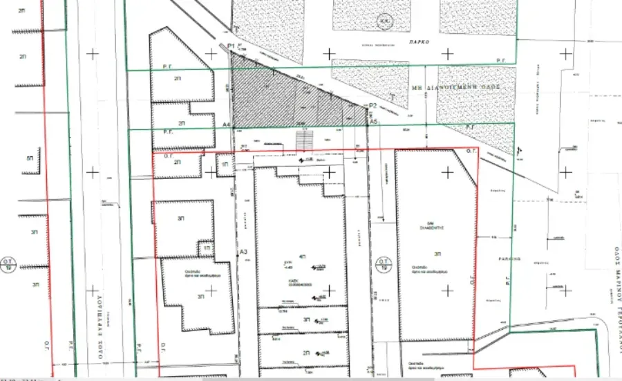
Topographic Plan
A topographic plan is a specialized technical drawing that accurately depicts the location, shape, boundaries and key features of a property (plot or land parcel). It is prepared exclusively by a Chartered Engineer using modern equipment and technologies such as GPS, surveying instruments, and specialized data processing software. The topographic plan is an essential document for property documentation, ensuring compliance with applicable legislative requirements and technical standards.
Preparation and Use of a Topographic Plan is Required For:
- For the execution of real estate sales contracts, ensuring the accurate depiction of the property being transferred.
- For the issuance of building permits and other urban planning approvals.
- The registration process of properties in the National Cadastre, ensuring accurate record-keeping.
- The legalization of unauthorized constructions, in accordance with applicable legislation.
- Inspections conducted by public authorities (Urban Planning Departments, Forestry Service, Municipalities).
- Matters concerning forest maps, to prove that a property is non-forested.
- For applications for funding or subsidies through agricultural or development programs.
- For procedures to determine boundaries between neighboring properties or to resolve ownership disputes.
What is the Value of a Topographic Plan
A topographic plan is a critical tool for the documentation and protection of real estate, ensuring accuracy, legality, and security in every transaction concerning the property.
Its preparation by a Chartered Engineer guarantees:
- Ακριβή και λεπτομερή απεικόνιση των ορίων, θέσης και χαρακτηριστικών του ακινήτου.
- Avoidance of legal disputes or claims due to incorrect mappings.
- Validity and reliability in transactions, purchases, and investments
- Compliance with urban planning and cadastre requirements, ensuring acceptance by public authorities.
The Topographic Plan as the Foundation for the Protection and Future Utilization of Your Property
Why is it Necessary?
A topographic plan is an indispensable element in every procedure related to real estate. It ensures the accuracy, legality, and safeguarding of your property rights. Proper preparation and certification by an experienced and licensed engineer guarantee the protection of your assets.
Topographic Plans in Greece – Current Regulations (2025)
In Greece, topographic plans are subject to strict specifications and rules depending on the purpose for which the plan is prepared.
Who Can Prepare a Topographic Plan?
Only a Chartered Engineer (member of the Technical Chamber of Greece - TEE), such as:
- Rural and Surveying Engineer
- Civil Engineer
- Architect (under specific conditions)
The engineer must possess:
- A professional license
- Signature and official stamp
- Electronic submission to TEE (for contracts)
Electronic submission to TEE (required for contracts)
Since 2021, for every contract, transfer, sale or parental donation the following are required:
- Topographic plan referenced to EGSA '87
- Electronic topographic survey submission to TEE
- Electronic Property Identity for buildings or land parcels
Other Regulations
- Cadastre: Requires a topographic plan for property declaration or data correction.
- Forestry Service: Requires a topographic plan for objections to forest maps.
- Urban Planning Authorities: Require a topographic plan for building permits or legalization of unauthorized constructions.
- Banks/Registry Offices: Require a topographic plan for loans or contracts.